
Professional Drone Services
Drone Photography and Aerial Videos
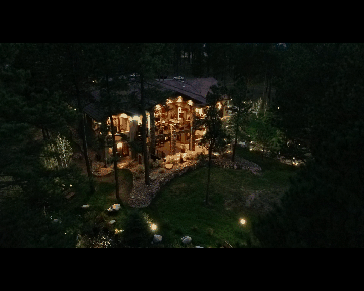
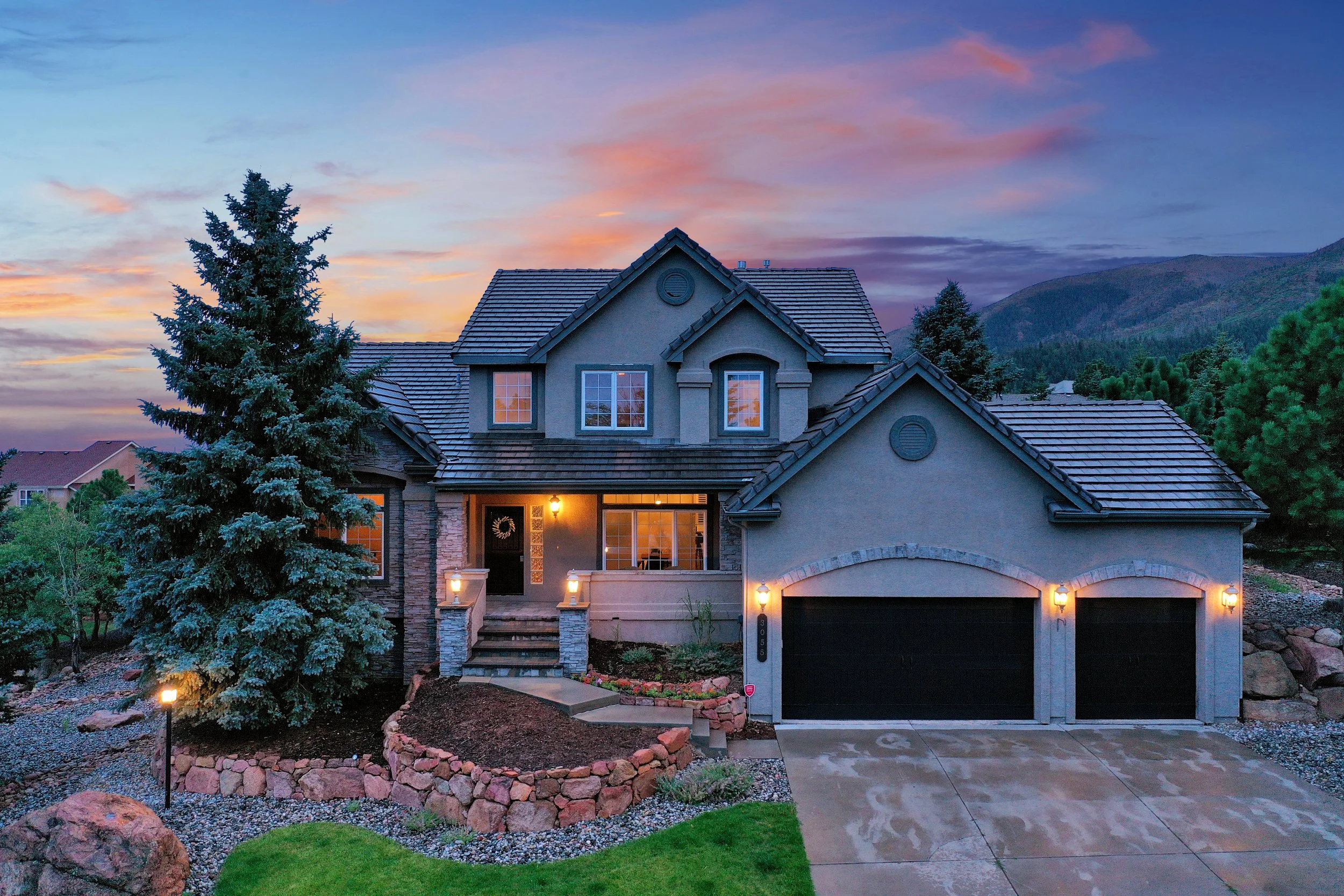
Elevate Your Perspective
There is no doubt that in today’s world, real estate agents need to use every tool at their disposal to get their listings top dollar. And that’s where we come in. Our drone services can help agents showcase their listings in a whole new way, and that can mean the difference between a home selling quickly or languishing on the market.
Sometimes the best thing to do for a listing is let people see it from a new angle.
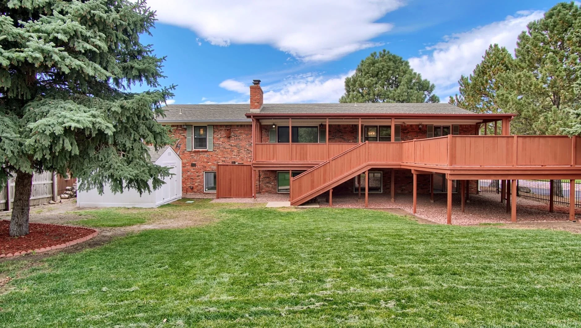
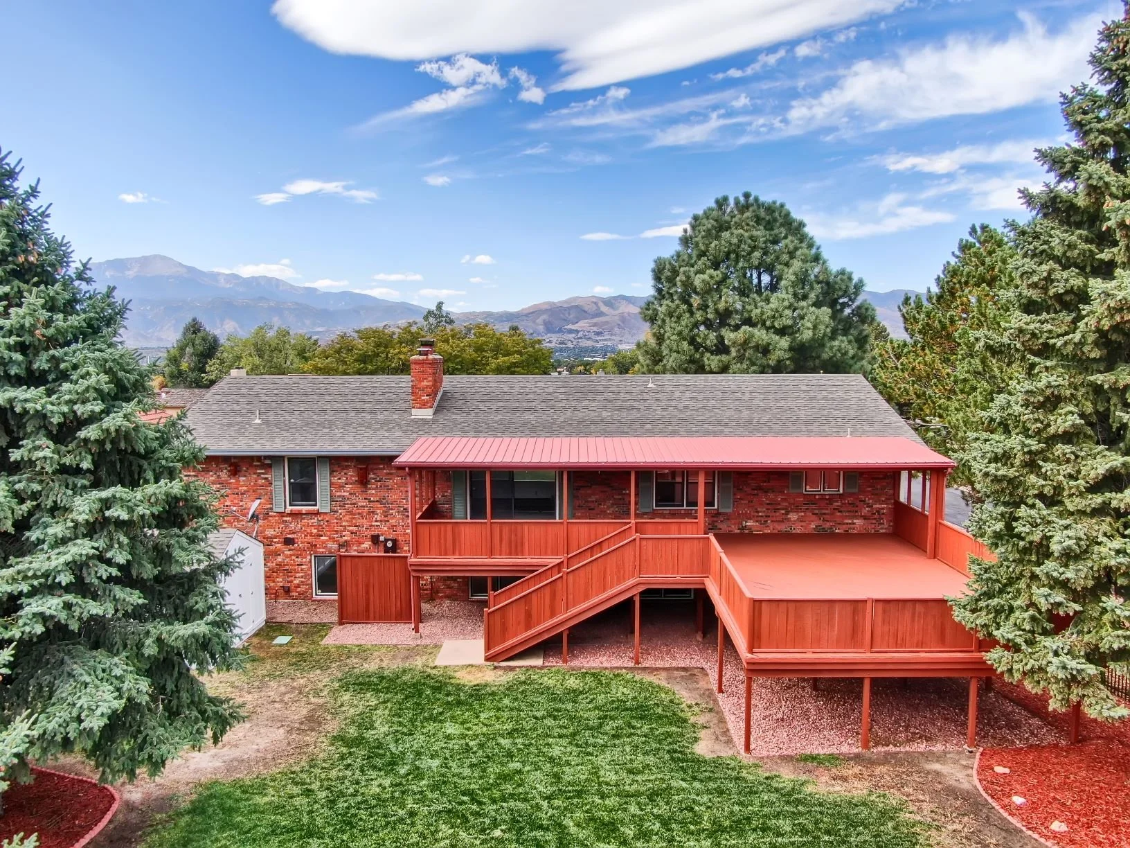
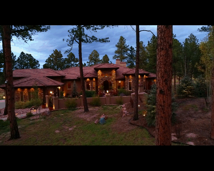
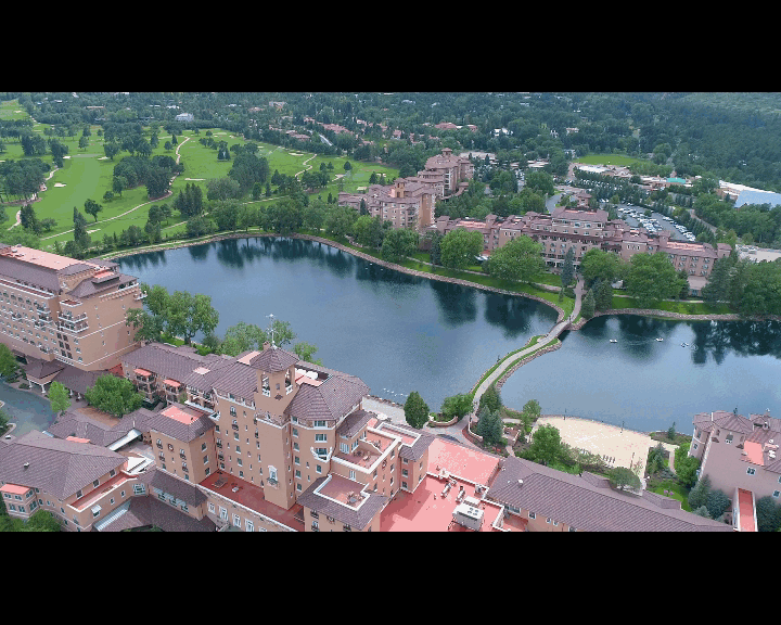
One of the best ways to showcase your location, community and views. Adding aerial photos is a great way to increase traffic to your listing. Our pilots are licensed under FAA Part 107 and carry insurance. With thousands of flights completed, we know how to capture the best angles to showcase your home.
A New Standard Of Marketing
Aerial photography is a great tool in your real estate marketing plan. Most properties can benefit from having a drone take some aerial imagery. If you’re not sure that your listing would benefit consider these advantages!
Helping the buyer get an idea of the community and neighborhood that the listing is located in. Aerials help people make sense of what they’re moving into.
If the listing has views or amenities close by like schools, parks and walking trails.
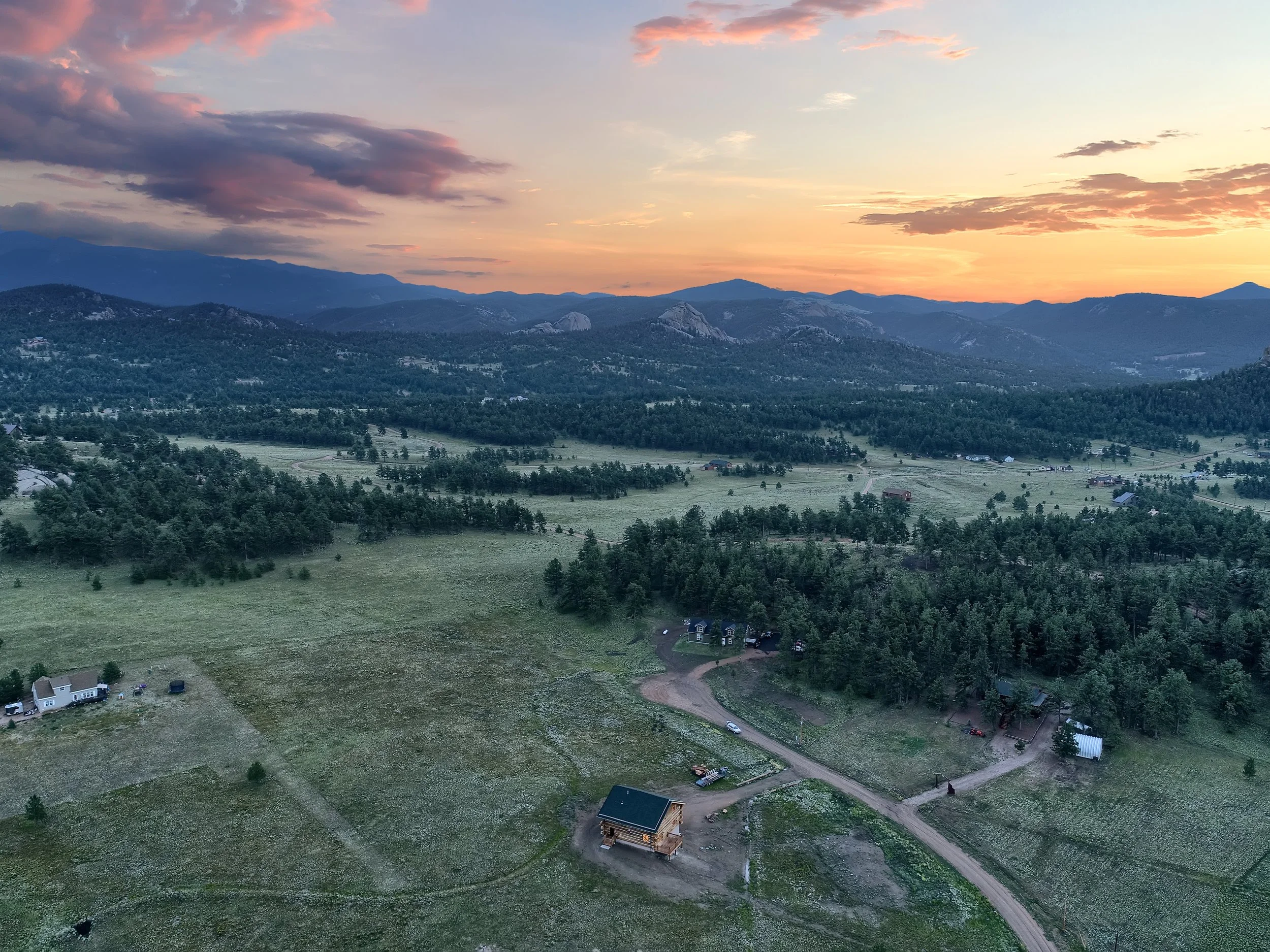
Vacant land or homes that have acreage are prime candidates for drone shots.
Mountain views? Even better - drone shots are excellent at showing those off.

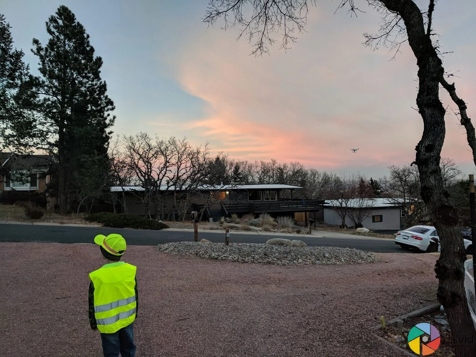
If you ever hired a drone pilot who arrived only to find out that their drone won’t even take off, you’ll know how important it is to hire someone who knows what they’re doing. We check the airspace on every address as soon as we get the order and again before we take off to make sure that we’re in compliance with all the regulations.
Some addresses require us to give the proper authorities at least 24 hours notice so please be sure to schedule aerial photos with that in mind.
Property Line Overlays
Sometimes you need to show the buyer where the property lines are. On a listing with vacant land or complex property lines, or even multiple lots, aerial video with property overlays can make a huge difference in helping prospective buyers visualize the property.
All we need is a plat map and some good aerial video to get started. If you are listing any kind of property with acreage, this is one of the best marketing tools out there for the following;
Vacant Land
Multiple Parcels or Lots
Large amount of acreage
New community development

Incredible Aerial Images - Professional Drone Service
-

Professional Drone Pilots
Our pilots are licensed and insured. We make sure to put all our pilots through our training that they must complete prior to being assigned aerial shots.
-
Cutting Edge Technology
We utilize the latest and greatest when it comes to getting high quality aerials. Our drone’s have professional grade cameras to really show your houses in the best light.
-

Command Attention
When your potential homeowner is scrolling through the listings, what grabs their attention? Drone photos and videos provide a unique scroll-stopping view of your listing.
-
Drone Videos
Our drones can capture stunning aerial footage and photos of any property, which can make it stand out from the competition. Additionally we can integrate our aerial videos with our ground video tours to really engage your potential buyers.
-

Showcase Vacant Land
Drones are a great way to showcase vacant land. With the use of a drone, real estate agents can capture video and photos from all angles which can give potential buyers a much better understanding of what the property or community looks like with our property line overlays.
Additionally, aerial footage can show the size and layout of the property in relation to its surroundings which can be very helpful for buyers who are looking to purchase acreage or large parcels of land.
-
Neighborhood Marketing Experts
Are you looking for a great way to showcase neighborhoods and communities? If so, you should consider using a drone. Drones can provide stunning aerial footage that can really capture the essence of a location.
They can be some of the best ways to show walking trails, community centers or nearby landmarks that would be important to your prospective buyer.
Check out some of our favorite aerial photos


If you’re located in Colorado Springs, Denver, or St. Louis and you’re interested in using drones to market your real estate listings, we at PixVid would be happy to help. We have years of experience providing quality real estate media services, and our pilots are licensed and insured.
Contact us today to learn more!

Luxury Home Twilight Walkthrough Video
Frequently Asked Questions About Drone Photography
-
We are one of the few companies that take great pains to make sure our flights are 100% above board. Our pilots are licensed (well technically certificated) under Part 107 and carry insurance.
We also have a number of Wide Area Authorizations that we operate under in several restricted airspaces. We currently hold authorizations for flights in USAFA, Buckley, Fort Carson airspace to name a few.
We check the airspace of the listing AS SOON as the order comes in and get any restrictions taken care of before the flight. If we can’t fly in a certain area, we will inform you as soon as we’re able to. -
We don’t fly unless we meet the FAA conditions required for safe flight. If it’s raining or visibility is bad, we won’t be able to take off and will reschedule at everyone’s earliest availability.
-
It depends on the airspace! In Class G airspace the ceiling is 400 feet unless we’re flying above a building. However most of our shots are taken at a low orbit between 25-75 feet and a higher orbit of 100-150 feet to make sure we capture all the necessary angles. Rarely do we need to go as high as 400 feet and we follow the restrictions each airspace has on the altitude.
-
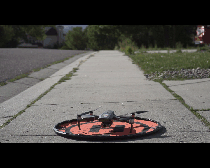
Drone photography or aerial photography is photography captured by an sUAS or small unmanned aerial system. We like to call them drone’s for simplicity’s sake. We typically use a standard commercial DJI or Autel model depending on the pilot and what equipment they have. Currently we prefer the Mavic series because they tend to be quieter in residential neighborhoods and have a great camera system to capture beautiful imagery including twilight shots.
-
We REALLY prefer not too for a number of reasons. Unless it’s a very specific type of drone that’s tailored to indoor flying, most drone’s GPS signal will be interrupted by the ceiling of the building and can cause the drone to malfunction or behave erratically in flight. Safety is our number one priority and while we’re really good pilots, it’s not worth risking the drone, or damaging the home to get a shot that a ground based photographer with a camera can get just as well.
-
We typically keep the drone operation to within 500 feet of the subject property because we have to keep the drone within visual line of site for safety reasons. If you would like us to capture additional footage of a community or landmark nearby, we’ll do our best to get it from our take off point without flying too far. If the shoot requires a separate take-off and landing location, we’ll have to charge accordingly for the extra time it takes to set up and take off.